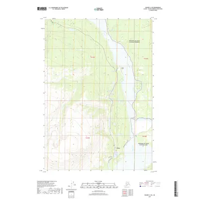
2019 Map of Valdez C-2 SE
USGS Topo · Published 2019About this map
Chitina sits at a critical geographic junction where the Copper River meets the mountains, serving as a gateway between the Wrangell-St. Elias National Park and the National Preserve. The landscape is defined by its dramatic water systems, including the Kotsina River and Kuskulana River which feed into the main Copper River channel. A chain of smaller water bodies, from First Lake up through Third Lake and Three Mile Lake, follows the corridor near the Chitina Airport, illustrating the narrow habitable zones between the high peaks and riverbanks.
Find a feature on this map
24 named features on this map. Tap any name to fly to it.
Don’t see what you’re looking for? This feature index may not catch every label — zoom into the map to look around manually.
Map Details
Editions of this 2019 Valdez C-2 SE Map
This is the sole edition of this map. No revisions or reprints were ever made.
Other maps of this area

1951 · Valdez B-2
USGS Topo · 1:63,360

1951 · Valdez B-1
USGS Topo · 1:63,360

1951 · Valdez C-2
USGS Topo · 1:63,360

1951 · Valdez C-1
USGS Topo · 1:63,360

1952 · Valdez
USGS Topo · 1:250,000

1953 · Valdez C-2
USGS Topo · 1:63,360

1953 · Valdez C-1
USGS Topo · 1:63,360

1960 · Valdez
USGS Topo · 1:250,000
1995 · Valdez B-1
USGS Topo · 1:63,360

1996 · Valdez C-2
USGS Topo · 1:63,360