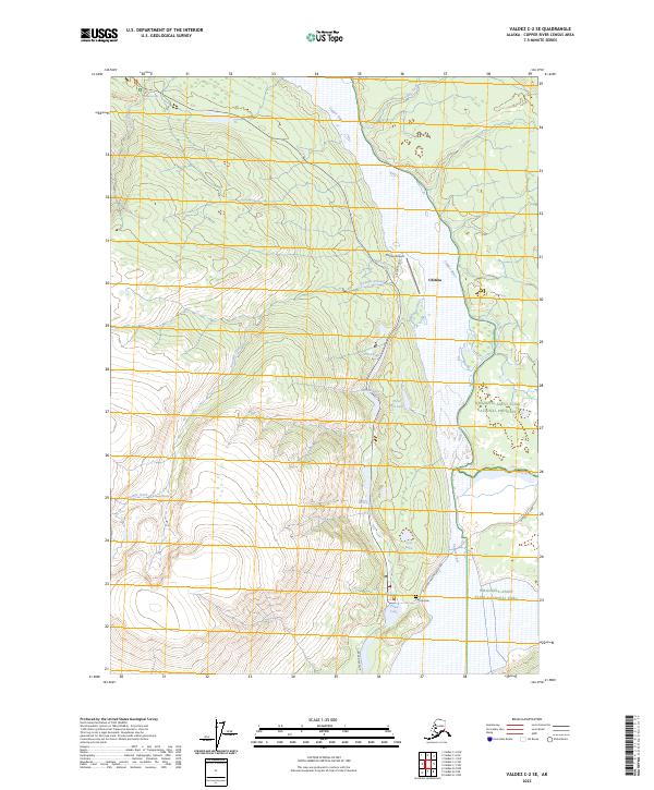
2023 Map of Valdez C-2 SE
USGS Topo · Published 2023About this map
Chitina sits at the convergence of vital interior transport routes and the massive drainage system of the Copper River. This 2023 survey illustrates the modern infrastructure serving this Copper River Valley community, including the Chitina Airport and the transition from the Edgerton Hwy/McCarthy Rd to the more remote McCarthy Road. The settlement's relationship with the surrounding landscape is defined by the high-relief terrain of the Wrangell-Saint Elias National Park and National Preserve, with numerous water bodies like Town Lake and Three Mile Lake dotting the valley floor. The map also includes the Chitina Cemetery south of the main townsite near the Village Road corridor. The braided channels of the Kotsina River meet the Copper River in the eastern portion of the quadrangle, highlighting the dynamic glacial hydrology of the region.
Find a feature on this map
25 named features on this map. Tap any name to fly to it.
Don’t see what you’re looking for? This feature index may not catch every label — zoom into the map to look around manually.
Map Details
Editions of this 2023 Valdez C-2 SE Map
This is the sole edition of this map. No revisions or reprints were ever made.
Other maps of this area

1951 · Valdez B-2
USGS Topo · 1:63,360

1951 · Valdez B-1
USGS Topo · 1:63,360

1951 · Valdez C-2
USGS Topo · 1:63,360

1951 · Valdez C-1
USGS Topo · 1:63,360

1952 · Valdez
USGS Topo · 1:250,000

1953 · Valdez C-2
USGS Topo · 1:63,360

1953 · Valdez C-1
USGS Topo · 1:63,360

1960 · Valdez
USGS Topo · 1:250,000
1995 · Valdez B-1
USGS Topo · 1:63,360

1996 · Valdez C-2
USGS Topo · 1:63,360