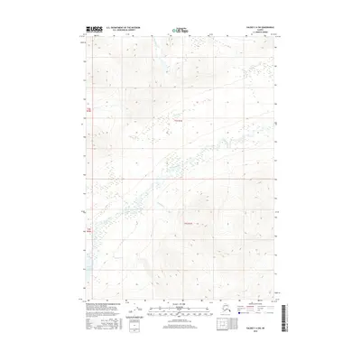
2016 Map of Valdez C-4 SW
USGS Topo · Published 2016About this map
Tonsina River defines the landscape of this southern interior Alaska survey, cutting through the center of the quadrangle where its braided channels create a complex hydrographic pattern. To the southwest, the waters of Tonsina Lake feed into this major drainage, while several prominent tributaries including Squirrel Cr, Rainbow Cr, and Quartz Cr drain the surrounding high elevation terrain. The map reflects a largely untouched wilderness area, partitioned by the townships of t3s r1w, t3s r2w, t4s r1w, and t4s r2w. This 2016 record captures the glacial and riverine morphology of the Chugach Mountains region, highlighting the dynamic nature of the river valley and the steep, high-relief contours that characterize this part of the Unorganized Borough.
Find a feature on this map
9 named features on this map. Tap any name to fly to it.
Don’t see what you’re looking for? This feature index may not catch every label — zoom into the map to look around manually.
Map Details
Editions of this 2016 Valdez C-4 SW Map
This is the sole edition of this map. No revisions or reprints were ever made.
Other maps of this area

1951 · Valdez B-5
USGS Topo · 1:63,360

1951 · Valdez C-4
USGS Topo · 1:63,360

1951 · Valdez B-4
USGS Topo · 1:63,360

1951 · Valdez C-5
USGS Topo · 1:63,360

1952 · Valdez
USGS Topo · 1:250,000

1953 · Valdez B-4
USGS Topo · 1:63,360

1953 · Valdez C-5
USGS Topo · 1:63,360

1953 · Valdez C-4
USGS Topo · 1:63,360

1960 · Valdez
USGS Topo · 1:250,000

1994 · Valdez B-4
USGS Topo · 1:63,360