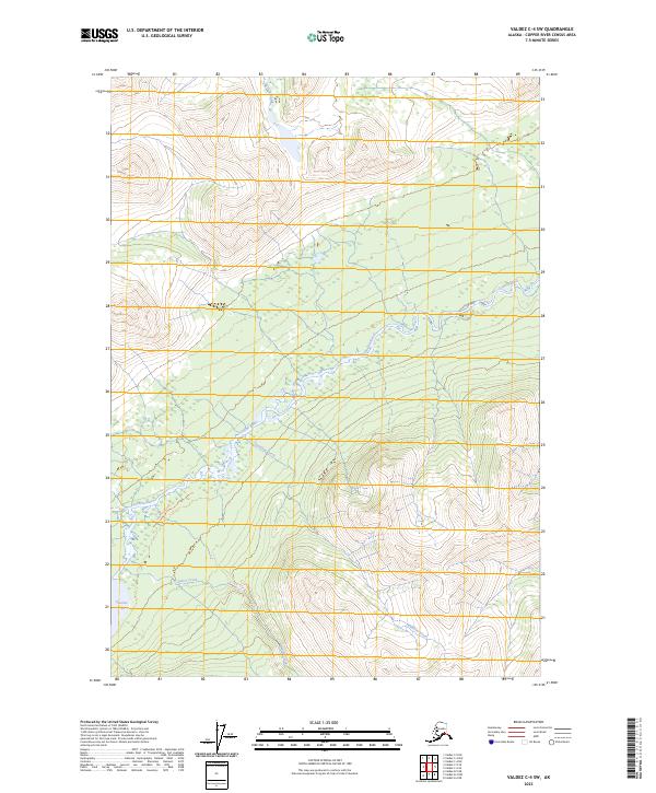
2023 Map of Valdez C-4 SW
USGS Topo · Published 2023About this map
The Tonsina River defines the drainage of this interior Alaskan landscape, winding through a corridor of significant elevation changes. This modern survey illustrates the rugged hydrological network where the river meets the Tonsina Lake outlet, a critical geographic marker for navigation and local transit. The map documents the Tonsina Lake Trl as it skirts the northern bank of the river, providing the primary overland access through this remote territory. Several significant tributaries, including Rainbow Creek, Quartz Creek, and Squirrel Creek, are shown in high detail as they feed into the main river system. This map is essential for understanding the contemporary topography and watershed patterns in the Valdez region, particularly for those tracing access routes along the river valley.
Find a feature on this map
11 named features on this map. Tap any name to fly to it.
Don’t see what you’re looking for? This feature index may not catch every label — zoom into the map to look around manually.
Map Details
Editions of this 2023 Valdez C-4 SW Map
This is the sole edition of this map. No revisions or reprints were ever made.
Other maps of this area

1951 · Valdez B-5
USGS Topo · 1:63,360

1951 · Valdez C-4
USGS Topo · 1:63,360

1951 · Valdez B-4
USGS Topo · 1:63,360

1951 · Valdez C-5
USGS Topo · 1:63,360

1952 · Valdez
USGS Topo · 1:250,000

1953 · Valdez B-4
USGS Topo · 1:63,360

1953 · Valdez C-5
USGS Topo · 1:63,360

1953 · Valdez C-4
USGS Topo · 1:63,360

1960 · Valdez
USGS Topo · 1:250,000

1994 · Valdez B-4
USGS Topo · 1:63,360