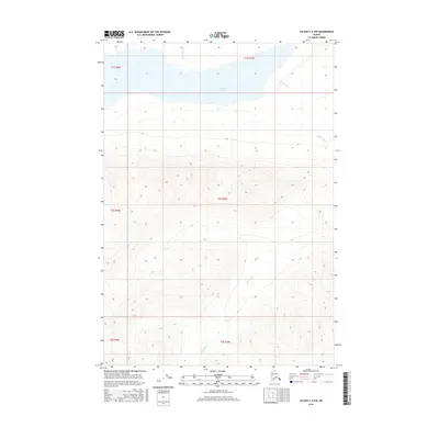
2016 Map of Valdez C-5 NW
USGS Topo · Published 2016About this map
Klutina Lake dominates the northern landscape of this interior terrain, where glacial waters feed into a complex hydrologic network. The shoreline of this major water body is defined by the steep elevation gains that characterize the Copper River basin drainage system. Flowing from the south, the Mahlo River cuts a prominent path through the southern townships before turning east, joined by smaller tributaries like Chultikana Cr. This 2016 survey illustrates the pristine nature of the region, showing the relationship between the high alpine contours and the river valleys that serve as the primary geographical markers in this part of the Unorganized Borough.
Find a feature on this map
9 named features on this map. Tap any name to fly to it.
Don’t see what you’re looking for? This feature index may not catch every label — zoom into the map to look around manually.
Map Details
Editions of this 2016 Valdez C-5 NW Map
This is the sole edition of this map. No revisions or reprints were ever made.
Other maps of this area

1948 · Valdez D-5
USGS Topo · 1:63,360

1949 · Valdez D-6
USGS Topo · 1:63,360

1950 · Valdez C-6
USGS Topo · 1:63,360

1951 · Valdez D-5
USGS Topo · 1:63,360

1951 · Valdez D-6
USGS Topo · 1:63,360

1951 · Valdez C-5
USGS Topo · 1:63,360

1952 · Valdez
USGS Topo · 1:250,000

1953 · Valdez C-6
USGS Topo · 1:63,360

1953 · Valdez C-5
USGS Topo · 1:63,360

1960 · Valdez
USGS Topo · 1:250,000