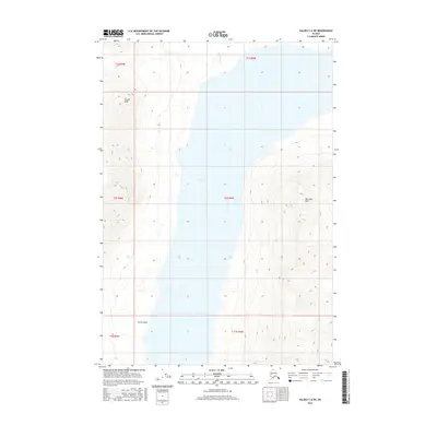
2016 Map of Valdez C-6 NE
USGS Topo · Published 2016About this map
Klutina Lake dominates this glacial landscape, filling a deep, narrow trough between high mountain ridges. The terrain reflects the massive scale of the interior, with the waters fed by high-altitude drainages such as Saint Anne Cr to the north. These features illustrate the natural hydrology of the Copper River basin before any significant human development, where the shoreline remains largely untouched. On either side of the lake, the topography rises sharply to prominent summits including Powell Peak in the northwest and Marshall Mtn to the east. The steep descent of Curtis Gulch highlights the dramatic vertical relief of the Chugach Mountains, where drainage patterns are dictated by the underlying geology of the Unorganized Borough.
Find a feature on this map
5 named features on this map. Tap any name to fly to it.
Don’t see what you’re looking for? This feature index may not catch every label — zoom into the map to look around manually.
Map Details
Editions of this 2016 Valdez C-6 NE Map
This is the sole edition of this map. No revisions or reprints were ever made.
Other maps of this area

1948 · Valdez D-5
USGS Topo · 1:63,360

1949 · Valdez D-6
USGS Topo · 1:63,360

1950 · Valdez C-6
USGS Topo · 1:63,360

1951 · Valdez D-5
USGS Topo · 1:63,360

1951 · Valdez D-6
USGS Topo · 1:63,360

1951 · Valdez C-5
USGS Topo · 1:63,360

1952 · Valdez
USGS Topo · 1:250,000

1953 · Valdez C-6
USGS Topo · 1:63,360

1953 · Valdez C-5
USGS Topo · 1:63,360

1960 · Valdez
USGS Topo · 1:250,000