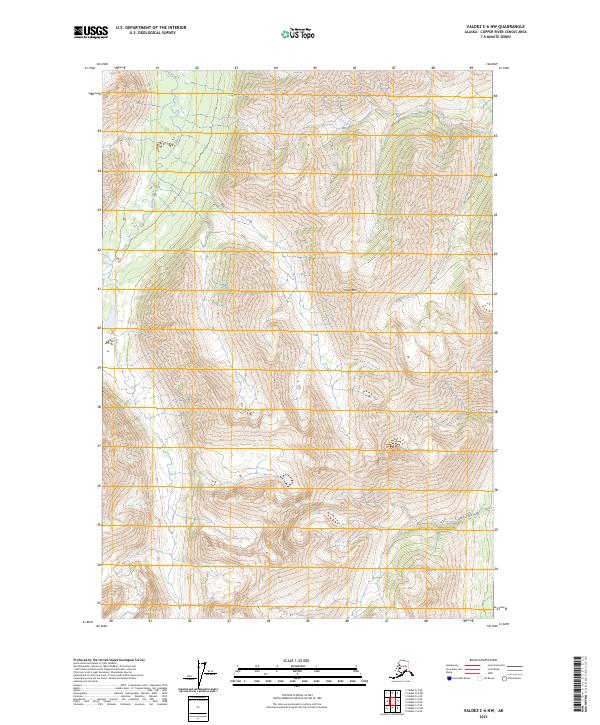
2023 Map of Valdez C-6 NW
USGS Topo · Published 2023About this map
Dyke Mtn dominates this high-altitude landscape within the Copper River Census Area, a region defined by steep elevational shifts and glacial drainage patterns. The drainage of Kaina Creek cuts through the western reaches of the quadrangle, while Curtis Gulch marks the southeastern corner. This 2023 survey illustrates the complex topography of the Alaska Range where it meets the Copper River basin, emphasizing the sheer verticality of the terrain without the presence of modern road infrastructure or permanent settlements. The map highlights the vast, undeveloped character of the Alaska interior, where geographic features are defined by water flow and mountain peaks rather than human habitation.
Find a feature on this map
9 named features on this map. Tap any name to fly to it.
Don’t see what you’re looking for? This feature index may not catch every label — zoom into the map to look around manually.
Map Details
Editions of this 2023 Valdez C-6 NW Map
This is the sole edition of this map. No revisions or reprints were ever made.
Other maps of this area

1949 · Valdez D-6
USGS Topo · 1:63,360

1949 · Valdez D-7
USGS Topo · 1:63,360

1950 · Valdez C-6
USGS Topo · 1:63,360

1951 · Valdez D-6
USGS Topo · 1:63,360

1951 · Valdez D-7
USGS Topo · 1:63,360

1952 · Valdez
USGS Topo · 1:250,000

1953 · Valdez C-6
USGS Topo · 1:63,360

1960 · Valdez C-7
USGS Topo · 1:63,360

1960 · Valdez
USGS Topo · 1:250,000
1993 · Valdez D-7
USGS Topo · 1:63,360