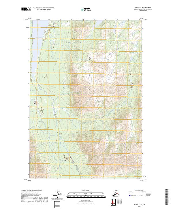
2023 Map of Valdez D-6 SE
USGS Topo · Published 2023About this map
Saint Anne Lake and its outlet, Saint Anne Creek, dominate the western landscape of this interior Alaskan wilderness. The terrain is defined by dramatic elevation changes, culminating in the prominent summit of Cranberry Peak to the south. This 2023 survey illustrates the rugged drainage patterns and glacial landforms characteristic of the Copper River Census Area. The map provides a detailed view of the township and range divisions, including t1n r5w and t1s r4w, which are essential for identifying specific land tracts in this expansive territory. The absence of roads or permanent structures underscores the remote, undeveloped nature of the region, making it an important record for those studying the preservation of subarctic ecosystems and topographical surveying in the early 21st century.
Find a feature on this map
7 named features on this map. Tap any name to fly to it.
Don’t see what you’re looking for? This feature index may not catch every label — zoom into the map to look around manually.
Map Details
Editions of this 2023 Valdez D-6 SE Map
This is the sole edition of this map. No revisions or reprints were ever made.
Other maps of this area

1948 · Valdez D-5
USGS Topo · 1:63,360

1949 · Valdez D-6
USGS Topo · 1:63,360

1950 · Valdez C-6
USGS Topo · 1:63,360

1951 · Valdez D-5
USGS Topo · 1:63,360

1951 · Valdez D-6
USGS Topo · 1:63,360

1951 · Valdez C-5
USGS Topo · 1:63,360

1952 · Valdez
USGS Topo · 1:250,000

1953 · Valdez C-6
USGS Topo · 1:63,360

1953 · Valdez C-5
USGS Topo · 1:63,360

1960 · Valdez
USGS Topo · 1:250,000