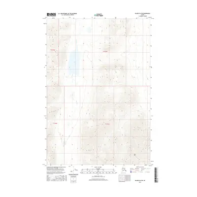
2016 Map of Valdez D-6 SW
USGS Topo · Published 2016About this map
Kaina Lake sits centered in this interior Alaskan landscape, a significant body of water fed and drained by the wandering course of Kaina Cr. The terrain is defined by high-elevation relief, rising toward the south where Wests Peak dominates the local horizon. This 2016 survey illustrates a largely roadless wilderness, with the landscape segmented by the grid lines of the Public Land Survey System, including t1n r5w and t1s r6w. The drainage patterns and topographic contours reveal a complex watershed where water bodies like Kaina Lake serve as natural collection points for the surrounding mountain runoff.
Find a feature on this map
7 named features on this map. Tap any name to fly to it.
Don’t see what you’re looking for? This feature index may not catch every label — zoom into the map to look around manually.
Map Details
Editions of this 2016 Valdez D-6 SW Map
This is the sole edition of this map. No revisions or reprints were ever made.
Other maps of this area

1949 · Valdez D-6
USGS Topo · 1:63,360

1949 · Valdez D-7
USGS Topo · 1:63,360

1950 · Valdez C-6
USGS Topo · 1:63,360

1951 · Valdez D-6
USGS Topo · 1:63,360

1951 · Valdez D-7
USGS Topo · 1:63,360

1952 · Valdez
USGS Topo · 1:250,000

1953 · Valdez C-6
USGS Topo · 1:63,360

1960 · Valdez C-7
USGS Topo · 1:63,360

1960 · Valdez
USGS Topo · 1:250,000
1993 · Valdez D-7
USGS Topo · 1:63,360