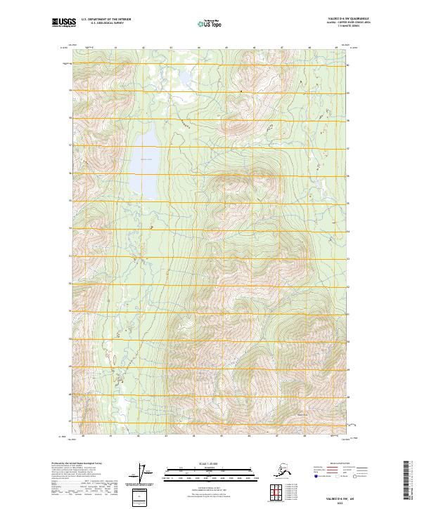
2023 Map of Valdez D-6 SW
USGS Topo · Published 2023About this map
Kaina Lake sits at the center of this Copper River Census Area terrain, serving as a focal point for the drainage network of Kaina Creek. The landscape is dominated by significant elevation changes, culminating in the prominent summit of Wests Peak in the southeastern quadrant. This 2023 survey by the U.S. Geological Survey illustrates a wilderness largely defined by its natural topography and hydrography rather than human infrastructure, as evidenced by the lack of named roads or settlements. The drainage patterns of the creek and its tributaries reveal a complex watershed within the Copper River basin, captured here with modern precision.
Find a feature on this map
7 named features on this map. Tap any name to fly to it.
Don’t see what you’re looking for? This feature index may not catch every label — zoom into the map to look around manually.
Map Details
Editions of this 2023 Valdez D-6 SW Map
This is the sole edition of this map. No revisions or reprints were ever made.
Other maps of this area

1949 · Valdez D-6
USGS Topo · 1:63,360

1949 · Valdez D-7
USGS Topo · 1:63,360

1950 · Valdez C-6
USGS Topo · 1:63,360

1951 · Valdez D-6
USGS Topo · 1:63,360

1951 · Valdez D-7
USGS Topo · 1:63,360

1952 · Valdez
USGS Topo · 1:250,000

1953 · Valdez C-6
USGS Topo · 1:63,360

1960 · Valdez C-7
USGS Topo · 1:63,360

1960 · Valdez
USGS Topo · 1:250,000
1993 · Valdez D-7
USGS Topo · 1:63,360