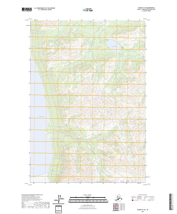
2023 Map of Valdez D-7 SE
USGS Topo · Published 2023About this map
Tazlina Lake dominates the western edge of this Copper River Census Area terrain, where the shoreline meets an intricate system of steep glacial valleys and high alpine basins. The landscape is defined by its dramatic elevation changes, with Tokama Creek carving through the central uplands as it drains toward the larger water bodies. This area, represented by township boundaries such as t1n r6w and t1s r7w, remains largely undeveloped, showcasing the raw hydrography of the Alaskan interior. At the northern end of the quadrangle, High Lake sits perched among the ridges, offering a contrast to the wide expanse of the lake below. The lack of road infrastructure emphasizes the isolation of this region, where natural drainages and topographic contours are the primary markers for navigation.
Find a feature on this map
7 named features on this map. Tap any name to fly to it.
Don’t see what you’re looking for? This feature index may not catch every label — zoom into the map to look around manually.
Map Details
Editions of this 2023 Valdez D-7 SE Map
This is the sole edition of this map. No revisions or reprints were ever made.
Other maps of this area

1949 · Valdez D-6
USGS Topo · 1:63,360

1949 · Valdez D-7
USGS Topo · 1:63,360

1950 · Valdez C-6
USGS Topo · 1:63,360

1951 · Valdez D-6
USGS Topo · 1:63,360

1951 · Valdez D-7
USGS Topo · 1:63,360

1952 · Valdez
USGS Topo · 1:250,000

1953 · Valdez C-6
USGS Topo · 1:63,360

1960 · Valdez C-7
USGS Topo · 1:63,360

1960 · Valdez
USGS Topo · 1:250,000
1993 · Valdez D-7
USGS Topo · 1:63,360