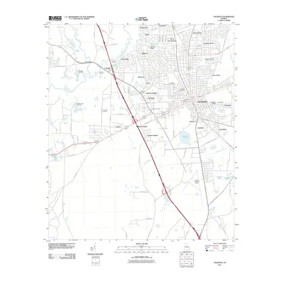
2011 Map of Valdosta
USGS Topo · Published 2011About this map
Valdosta and its surrounding Lowndes County landscape are defined here by a complex drainage system where the Withlacoochee River meets the Little River northwest of the city. This 2011 survey captures the urban expansion of neighborhoods like Lakeland Forest and Charter Oaks alongside older, established enclaves such as Remerton. The presence of numerous historic burial sites, including Riverhill Cemetery, Sunset Hill Cemetery, and Pallbearers Cemetery, provides significant data for genealogical research within the city's shifting boundaries. To the south, the industrial and logistical character of the region is evident through the Valdosta Regional Airport and the rail infrastructure at Langdale Yard, while the expansive Mud Swamp to the southeast marks the natural limit of contemporary development.
Find a feature on this map
82 named features on this map. Tap any name to fly to it.
Don’t see what you’re looking for? This feature index may not catch every label — zoom into the map to look around manually.
Map Details
Editions of this 2011 Valdosta Map
This is the sole edition of this map. No revisions or reprints were ever made.
Other maps of this area

1954 · Valdosta
USGS Topo · 1:250,000

1956 · Clyattville
USGS Topo · 1:24,000

1956 · Nankin
USGS Topo · 1:24,000

1958 · Valdosta
USGS Topo · 1:250,000

1959 · Valdosta
USGS Topo · 1:250,000

1961 · Hahira East
USGS Topo · 1:24,000

1961 · Valdosta
USGS Topo · 1:24,000

1961 · Hahira West
USGS Topo · 1:24,000

1961 · Ousley
USGS Topo · 1:24,000

1971 · Indianola
USGS Topo · 1:24,000