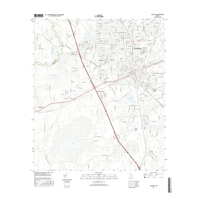
2017 Map of Valdosta
USGS Topo · Published 2017About this map
The Withlacoochee River and Little River converge in the western reach of this South Georgia landscape, framing the historical development of Lowndes County. The city of Valdosta serves as the primary urban hub, with its suburban expansion reaching toward smaller enclaves like Remerton and Troupville. This survey illustrates the transition from high-density university and residential areas near Valdosta State Univ to the lower-lying hydrological features to the south, such as Mud Swamp and Fern Pond. Cultural landmarks including the Chesley Sharpe Memorial Bridge and Sunset Hill Cem are situated alongside modern infrastructure like the Valdosta Regional Airport. The topography is characterized by a network of drainage basins and numerous ponds, including Wetherington Lake and Langdales Pond, which historically influenced local transport routes like Spain Ferry Rd.
Find a feature on this map
39 named features on this map. Tap any name to fly to it.
Don’t see what you’re looking for? This feature index may not catch every label — zoom into the map to look around manually.
Map Details
Editions of this 2017 Valdosta Map
This is the sole edition of this map. No revisions or reprints were ever made.
Other maps of this area

1954 · Valdosta
USGS Topo · 1:250,000

1956 · Clyattville
USGS Topo · 1:24,000

1956 · Nankin
USGS Topo · 1:24,000

1958 · Valdosta
USGS Topo · 1:250,000

1959 · Valdosta
USGS Topo · 1:250,000

1961 · Hahira East
USGS Topo · 1:24,000

1961 · Valdosta
USGS Topo · 1:24,000

1961 · Hahira West
USGS Topo · 1:24,000

1961 · Ousley
USGS Topo · 1:24,000

1971 · Indianola
USGS Topo · 1:24,000