
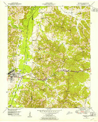
1936 Map of Vale
USGS Topo · Published 1936About this map
Arthur E. Morgan and Carl A. Bock of the Tennessee Valley Authority directed this field examination of Carroll County during a period of significant regional infrastructure development. The landscape is defined by the Divide Ridge and the Barren Tennessee Basin, where rural life centered on small community hubs like Crews Store and the town of Vale. The area's transport network was dominated by the Nashville Chattanooga and St Louis railroad, which supported local industry through features like Coopers Spur near Bruceton. Local genealogy is well-represented through numerous rural institutions, including Hebron Ch, Pisgah Ch, and schools such as Barren Spring Sch and Marlborough Sch. The proximity of Hollow Rock Branch and Cherry Creek to these settlements illustrates how early Tennessee communities were closely tied to both the rails and local water sources.
Find a feature on this map
23 named features on this map. Tap any name to fly to it.
Don’t see what you’re looking for? This feature index may not catch every label — zoom into the map to look around manually.
Map Details
Editions of this 1936 Vale Map
This is the sole edition of this map. No revisions or reprints were ever made.
Other maps of this area

1936 · Seventeen Creek
USGS Topo · 1:24,000

1936 · Mansfield
USGS Topo · 1:24,000

1936 · Center Ridge
USGS Topo · 1:24,000

1936 · Bruceton
USGS Topo · 1:24,000

1936 · Buena Vista
USGS Topo · 1:24,000

1936 · Manleyville
USGS Topo · 1:24,000

1940 · Manleyville
USGS Topo · 1:24,000

1941 · Manleyville
USGS Topo · 1:24,000

1950 · Palmer Shelter
USGS Topo · 1:24,000
1950 · Bruceton
USGS Topo · 1:24,000