
1934 Map of Valier
USGS Topo · Published 1962About this map
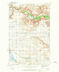
Lake Frances and its essential Lake Frances Dam anchor the southwestern corner of this Montana landscape, where the Montana Western railroad terminates at the town of Valier. The 1934 surveying reveals a sophisticated network of irrigation, with various Canal lines traversing Bullhead Valley and Winginaw Valley, illustrating the agricultural engineering required to sustain life on the plains.
Find a feature on this map
45 named features on this map. Tap any name to fly to it.
Don’t see what you’re looking for? This feature index may not catch every label — zoom into the map to look around manually.
Map Details
Editions of this 1934 Valier Map
2 editions found
Other maps of this area

1907 · Blackfoot Res.
USGS Topo · 1:48,000

1909 · Cut Bank
USGS Topo · 1:125,000

1912 · Cut Bank
USGS Topo · 1:125,000

1920 · Dupuyer
USGS Topo · 1:125,000

1920 · Conrad
USGS Topo · 1:125,000

1934 · Lake Frances
USGS Topo · 1:48,000

1936 · Pendroy
USGS Topo · 1:48,000

1937 · Valier
USGS Topo · 1:62,500

1937 · Lake Frances
USGS Topo · 1:62,500

1938 · Gallup City
USGS Topo · 1:62,500