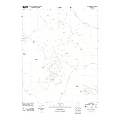
2011 Map of Valle Toledo
USGS Topo · Published 2011About this map
Valle Toledo and its adjacent montane meadows define this high-altitude landscape within the Jemez Mountains. The terrain is characterized by large open basins and volcanic peaks, including Cerro Toledo and Pajarito Mountain. This 2011 survey documents the drainage patterns of the San Antonio Creek and the headwaters of the East Fork Jemez River, which wind through the valles. On the eastern edge, the Pajarito Mountain Ski Area and the Quemazon Trl provide evidence of modern recreational use. The map also captures several traditional transit corridors, such as Indian Service Route 602 near Turkey Canyon. The nomenclature of the region, from Rincon de los Soldados to Sierra de los Valles, reflects the deep Spanish and indigenous cultural history of Sandoval County, where these high valleys served as vital grazing lands for generations.
Find a feature on this map
29 named features on this map. Tap any name to fly to it.
Don’t see what you’re looking for? This feature index may not catch every label — zoom into the map to look around manually.
Map Details
Editions of this 2011 Valle Toledo Map
This is the sole edition of this map. No revisions or reprints were ever made.
Other maps of this area

1890 · Jemes
USGS Topo · 1:125,000

1892 · Jemes
USGS Topo · 1:125,000

1892 · Santa Clara
USGS Topo · 1:125,000

1909 · Gallina
USGS Topo · 1:125,000

1918 · Abiquiu
USGS Topo · 1:125,000

1937 · Jemez Springs
USGS Topo · 1:48,000

1944 · Jemez Springs
USGS Topo · 1:62,500

1952 · Valle Toledo
USGS Topo · 1:24,000

1952 · Jemez Springs
USGS Topo · 1:62,500

1952 · Frijoles
USGS Topo · 1:24,000