
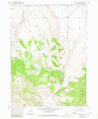
1964 Map of Valley Falls
USGS Topo · Published 1965About this map
Valley Falls serves as the focal point of this high-desert landscape in Lake County, situated at the confluence of several vital water sources. The 1964 field data reveals a region defined by its springs and seasonal catchments, such as Red Knoll Reservoir and Bowersox Lake. The terrain transitions from the open expanse of Coyote Flat to the heavily wooded slopes of the Fremont National Forest, where smaller features like Bull Meadow and Woodchopper Spring provided essential resources for early ranching and forest management.
Find a feature on this map
34 named features on this map. Tap any name to fly to it.
Don’t see what you’re looking for? This feature index may not catch every label — zoom into the map to look around manually.
Map Details
Editions of this 1964 Valley Falls Map
2 editions found
Other maps of this area

1955 · Klamath Falls
USGS Topo · 1:250,000

1958 · Klamath Falls
USGS Topo · 1:250,000

1964 · Crooked Creek Valley
USGS Topo · 1:24,000

1964 · Clover Flat
USGS Topo · 1:24,000

1964 · Big Baldy
USGS Topo · 1:24,000

1966 · Tucker Hill
USGS Topo · 1:24,000

1966 · Coglan Buttes SE
USGS Topo · 1:24,000

1968 · Crook Peak
USGS Topo · 1:24,000

1968 · Lake Abert South
USGS Topo · 1:24,000
1968 · Little Honey Creek
USGS Topo · 1:24,000