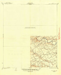
1931 Map of Valley Mills
USGS Topo · Published 1949About this map
The North Bosque River and Middle Bosque River dominate this Central Texas landscape, captured in a survey that details the agricultural settlements and river crossings of the early 1920s. The map illustrates a rural network of small communities and social centers, including Speegleville, Willow Grove, and Ocee, along with family-linked landmarks like Windsor. Educational and spiritual life is anchored by local institutions such as Mt Zion Sch, Midway Sch, and Shiloh Ch.
Find a feature on this map
22 named features on this map. Tap any name to fly to it.
Don’t see what you’re looking for? This feature index may not catch every label — zoom into the map to look around manually.
Map Details
Editions of this 1931 Valley Mills Map
2 editions found
Other maps of this area

1888 · Meridian
USGS Topo · 1:125,000

1892 · Temple
USGS Topo · 1:125,000

1892 · Waco
USGS Topo · 1:125,000

1894 · Meridian
USGS Topo · 1:125,000

1894 · Gatesville
USGS Topo · 1:125,000

1920 · Waco
USGS Topo · 1:125,000

1924 · Waco 4-c
USGS Topo · 1:48,000

1924 · Waco 3-d
USGS Topo · 1:48,000

1931 · Whitney
USGS Topo · 1:62,500

1931 · Valley Mills
USGS Topo · 1:62,500