
1931 Map of Valley Mills
USGS Topo · Published 1931About this map
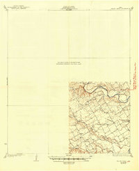
The North Bosque River and Middle Bosque River carve through McLennan County, shaping a rural landscape of dispersed farming communities and river crossings. This 1931 edition reflects a topography defined by local social hubs, where Lone Hill Ch and Shiloh Ch stand as landmarks for the surrounding homesteads. The importance of the river for local transit is evident in named fords such as Eichelberger Crossing and Flat Rock Crossing, which provided essential passage before the widespread construction of modern bridges.
Find a feature on this map
20 named features on this map. Tap any name to fly to it.
Don’t see what you’re looking for? This feature index may not catch every label — zoom into the map to look around manually.
Map Details
Editions of this 1931 Valley Mills Map
2 editions found
Other maps of this area

1888 · Meridian
USGS Topo · 1:125,000

1892 · Temple
USGS Topo · 1:125,000

1892 · Waco
USGS Topo · 1:125,000

1894 · Meridian
USGS Topo · 1:125,000

1894 · Gatesville
USGS Topo · 1:125,000

1920 · Waco
USGS Topo · 1:125,000

1924 · Waco 4-c
USGS Topo · 1:48,000

1924 · Waco 3-d
USGS Topo · 1:48,000

1931 · Whitney
USGS Topo · 1:62,500

1931 · Elm Mott
USGS Topo · 1:62,500