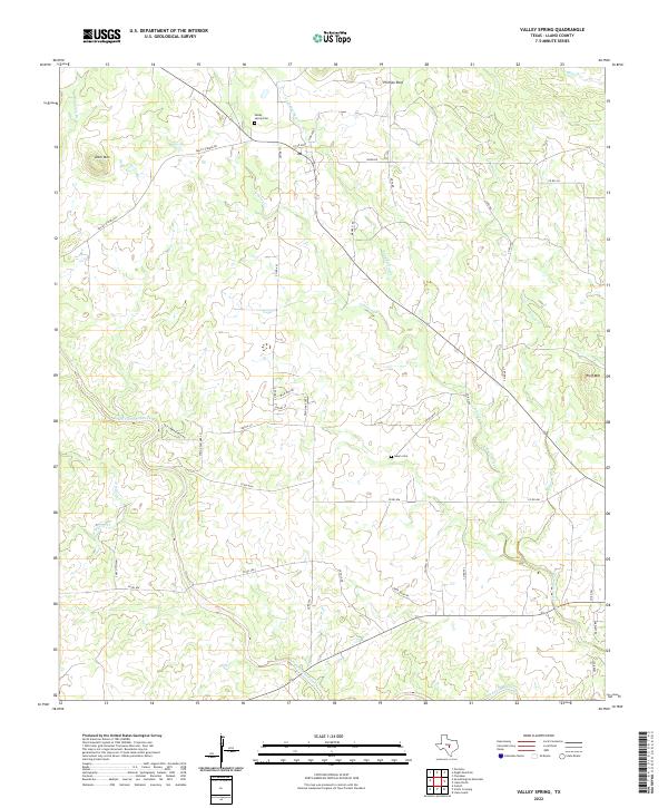
2022 Map of Valley Spring
USGS Topo · Published 2022About this map
San Fernando Creek and its many tributaries, including Sand Spring Cr and Johnson Creek, define the topography of this Llano County landscape. The area is characterized by low-density ranching and rural residential development, with the small community at Valley Springs Rd serving as a central point for local families. This 2022 survey documents enduring landmarks such as Phillips Rock and Deer Mtn, which have likely served as navigational points for generations of residents. For genealogists and local historians, the map provides precise locations for the Valley Spring Cem and the Salem Cem, situated near the junction of several county roads like Gary Rd and Co Rd 403. The road network, including names like Salt Creek Ranch Rd and Deer Country, reflects the modern rural character of the Texas Hill Country.
Find a feature on this map
43 named features on this map. Tap any name to fly to it.
Don’t see what you’re looking for? This feature index may not catch every label — zoom into the map to look around manually.
Map Details
Editions of this 2022 Valley Spring Map
This is the sole edition of this map. No revisions or reprints were ever made.
Other maps of this area

1887 · Llano
USGS Topo · 1:125,000

1894 · Llano
USGS Topo · 1:125,000

1904 · Llano
USGS Topo · 1:125,000

1909 · Llano
USGS Topo · 1:125,000

1918 · Llano
USGS Topo · 1:125,000

1954 · Llano
USGS Topo · 1:250,000

1955 · Llano
USGS Topo · 1:250,000
1955 · Magill Mountain
USGS Topo · 1:24,000

1955 · Valley Spring
USGS Topo · 1:24,000
1955 · Llano North
USGS Topo · 1:24,000