
1961 Map of Valley
USGS Topo · Published 1963About this map
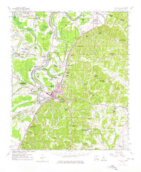
Yazoo City serves as the focal point for this Mississippi Delta landscape, situated where the Yazoo River meets the distinctive bluff line. The 1961 survey documents a dense network of rural community institutions, reflecting the era's segregated social geography through numerous named schools and churches such as Peter Simmons Sch, Holly Green Sch, and Mt Salem Sch & Ch. The land use is clearly divided between the alluvial floodplains to the west, marked by Wolf Lake and Broad Lake, and the dissected uplands to the east.
Find a feature on this map
79 named features on this map. Tap any name to fly to it.
Don’t see what you’re looking for? This feature index may not catch every label — zoom into the map to look around manually.
Map Details
Editions of this 1961 Valley Map
2 editions found
Other maps of this area

1940 · Auter
USGS Topo · 1:62,500

1940 · Lexington
USGS Topo · 1:62,500

1940 · Mechanicsburg
USGS Topo · 1:62,500

1940 · Mileston
USGS Topo · 1:62,500

1953 · Greenwood
USGS Topo · 1:250,000

1954 · Mileston
USGS Topo · 1:62,500

1955 · Jackson
USGS Topo · 1:250,000

1956 · Greenwood
USGS Topo · 1:250,000

1957 · Lexington
USGS Topo · 1:62,500

1958 · Lexington
USGS Topo · 1:62,500