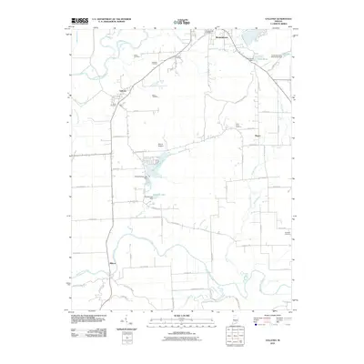
2010 Map of Vallonia
USGS Topo · Published 2010About this map
Vallonia sits as a central hub in this southern Indiana landscape, defined by its position near the sweeping curves of the East Fork White River. The region's history is preserved in a high density of rural burial grounds, including the Woodmansee Cemetery, Smith Cemetery, and Sturgeon Cemetery, which serve as vital markers for genealogical research in Jackson County. To the south, the Muscatatuck River meanders toward the settlement of Millport, creating a distinct riparian border.
Find a feature on this map
64 named features on this map. Tap any name to fly to it.
Don’t see what you’re looking for? This feature index may not catch every label — zoom into the map to look around manually.
Map Details
Editions of this 2010 Vallonia Map
This is the sole edition of this map. No revisions or reprints were ever made.
Other maps of this area

1951 · Smedley
USGS Topo · 1:24,000

1953 · Kossuth
USGS Topo · 1:24,000

1956 · Vincennes
USGS Topo · 1:250,000

1956 · Louisville
USGS Topo · 1:250,000

1957 · Vincennes
USGS Topo · 1:250,000

1958 · Vincennes
USGS Topo · 1:250,000

1958 · Little York
USGS Topo · 1:24,000

1958 · Brownstown
USGS Topo · 1:24,000

1958 · Seymour
USGS Topo · 1:24,000
1959 · Vallonia
USGS Topo · 1:24,000