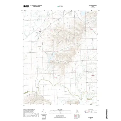
2019 Map of Vallonia
USGS Topo · Published 2019About this map
Brownstown and Vallonia anchor this southern Indiana landscape, situated where the broad bottomlands of the East Fork White River meet the rising terrain of the Knobs. The region is defined by its sophisticated drainage network, with numerous man-made channels like Wayman Ditch and Singer Ditch cutting through the fertile lowlands. Local history is deeply etched into the countryside through a high concentration of family and community burial grounds, including Miller Cem, Burrell Cem, and the Sturgeon Cem near the eastern border.
Find a feature on this map
104 named features on this map. Tap any name to fly to it.
Don’t see what you’re looking for? This feature index may not catch every label — zoom into the map to look around manually.
Map Details
Editions of this 2019 Vallonia Map
This is the sole edition of this map. No revisions or reprints were ever made.
Other maps of this area

1951 · Smedley
USGS Topo · 1:24,000

1953 · Kossuth
USGS Topo · 1:24,000

1956 · Vincennes
USGS Topo · 1:250,000

1956 · Louisville
USGS Topo · 1:250,000

1957 · Vincennes
USGS Topo · 1:250,000

1958 · Vincennes
USGS Topo · 1:250,000

1958 · Little York
USGS Topo · 1:24,000

1958 · Brownstown
USGS Topo · 1:24,000

1958 · Seymour
USGS Topo · 1:24,000
1959 · Vallonia
USGS Topo · 1:24,000