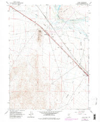
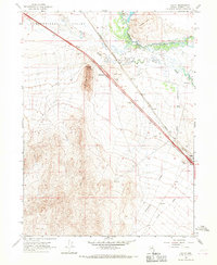
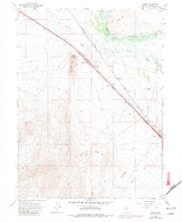
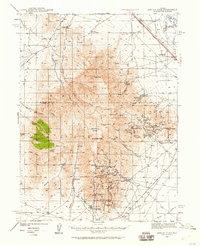
1965 Map of Valmy
USGS Topo · Published 1981About this map
The Humboldt River and the Southern Pacific railroad corridor dictate the layout of this high-desert landscape in northern Nevada. The small settlement of Valmy sits near the eastern edge of the survey, serving as a focal point along the transit lines that have historically connected this region. To the west, the broad Pumpernickel Valley stretches toward the base of Lone Tree Hill, where Stonehouse Spring and the Stonehouse Interchange mark an important junction of water and modern infrastructure.
Find a feature on this map
21 named features on this map. Tap any name to fly to it.
Don’t see what you’re looking for? This feature index may not catch every label — zoom into the map to look around manually.
Map Details
Editions of this 1965 Valmy Map
3 editions found
Other maps of this area

1932 · Sonoma Range
USGS Topo · 1:250,000

1939 · Sonoma Range
USGS Topo · 1:250,000
1940 · Antler Peak
USGS Topo · 1:62,500

1943 · Antler Peak
USGS Topo · 1:62,500

1955 · Winnemucca
USGS Topo · 1:250,000

1958 · Winnemucca
USGS Topo · 1:250,000

1962 · Winnemucca
USGS Topo · 1:250,000
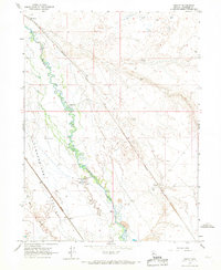
1965 · Knight
USGS Topo · 1:24,000
1965 · Edna Mountain
USGS Topo · 1:62,500
1965 · Brooks Spring
USGS Topo · 1:24,000