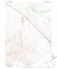
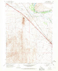
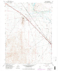
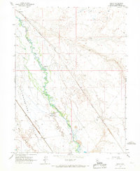
1965 Map of Valmy
USGS Topo · Published 1981About this map
The Humboldt River and its intricate drainage system of Herrin Slough and Cottonwood Creek dominate this 1965 survey of the Nevada landscape. To the west, the broad Pumpernickel Valley stretches toward the prominent peaks of Treaty Hill and Lone Tree Hill. The map documents a critical transportation corridor where the Southern Pacific railroad follows the river's path, intersected by major highway developments like the Stonehouse Interchange and the Valmy Interchange. Small-scale agricultural and ranching operations are evidenced by the presence of Nelson Ranch and Hunter Ranch, while natural water sources such as Stonehouse Spring and Plank Spr highlight the essential resources for desert survival and settlement. The transition of the terrain from flat valley floors to the winding river banks is captured with precise topographic detail.
Find a feature on this map
18 named features on this map. Tap any name to fly to it.
Don’t see what you’re looking for? This feature index may not catch every label — zoom into the map to look around manually.
Map Details
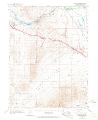
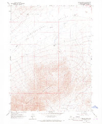
Editions of this 1965 Valmy Map
3 editions found
Other maps of this area

1932 · Sonoma Range
USGS Topo · 1:250,000

1939 · Sonoma Range
USGS Topo · 1:250,000
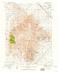
1940 · Antler Peak
USGS Topo · 1:62,500

1943 · Antler Peak
USGS Topo · 1:62,500

1955 · Winnemucca
USGS Topo · 1:250,000

1958 · Winnemucca
USGS Topo · 1:250,000

1962 · Winnemucca
USGS Topo · 1:250,000
1965 · Knight
USGS Topo · 1:24,000
1965 · Edna Mountain
USGS Topo · 1:62,500
1965 · Brooks Spring
USGS Topo · 1:24,000