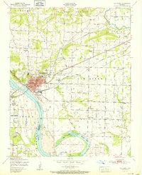
1951 Map of Van Buren
USGS Topo · Published 1951About this map
Van Buren serves as the focal point of this 1940s landscape, positioned along the northern bank of the Arkansas River. The city’s mid-century industrial footprint is clearly visible, including a Zinc smelter, several Strip mines, and the Smeltzer facility. The town's grid is flanked by the Missouri Pacific and St Louis-San Francisco railroads, which facilitated the movement of goods through this river-valley corridor.
Find a feature on this map
41 named features on this map. Tap any name to fly to it.
Don’t see what you’re looking for? This feature index may not catch every label — zoom into the map to look around manually.
Map Details
Editions of this 1951 Van Buren Map
2 editions found
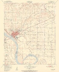
Other maps of this area

1879 · Fort Smith
USGS Topo · 1:62,500

1887 · Van Buren
USGS Topo · 1:62,500

1890 · Fort Smith
USGS Topo · 1:125,000

1898 · Winslow #4
USGS Topo · 1:62,500

1898 · Winslow #3
USGS Topo · 1:62,500

1898 · Winslow
USGS Topo · 1:125,000

1901 · Winslow
USGS Topo · 1:125,000

1906 · Lavaca
USGS Topo · 1:62,500

1943 · Fort Smith
USGS Topo · 1:125,000

1946 · Fort Smith
USGS Topo · 1:250,000