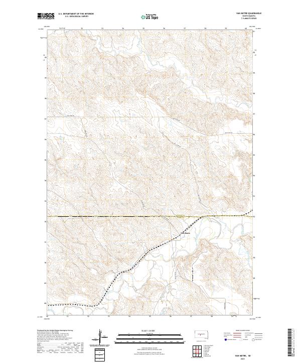
2021 Map of Van Metre
USGS Topo · Published 2021About this map
Van Metre sits at a geographic crossroads in South Dakota, where the undulating plains of Stanley and Jones Counties meet. This landscape is defined by the winding course of the Bad River, which snakes across the southern portion of the quadrangle. A network of local drainages, including Plum Creek and Brush Creek to the north, feeds into this central waterway, carving out the characteristic draws and breaks of the Missouri Plateau.
Find a feature on this map
15 named features on this map. Tap any name to fly to it.
Don’t see what you’re looking for? This feature index may not catch every label — zoom into the map to look around manually.
Map Details
Editions of this 2021 Van Metre Map
This is the sole edition of this map. No revisions or reprints were ever made.
Other maps of this area

1937 · Oahe
USGS Topo · 1:62,500

1951 · Capa
USGS Topo · 1:24,000

1951 · Van Metre
USGS Topo · 1:24,000

1951 · Capa NW
USGS Topo · 1:24,000

1951 · Capa SE
USGS Topo · 1:24,000

1953 · Oahe SW
USGS Topo · 1:24,000

1953 · Wendte
USGS Topo · 1:24,000

1954 · Pierre
USGS Topo · 1:250,000

1958 · Pierre
USGS Topo · 1:250,000
1972 · Wendte SW
USGS Topo · 1:24,000