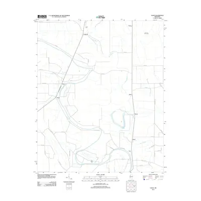
2012 Map of Vance
USGS Topo · Published 2012About this map
Buzzard Bayou meanders through this portion of the Mississippi Delta, anchoring a landscape of agricultural drainage and small rural settlements in the early 21st century. The map reveals a high density of local roads and property divisions, such as Cotton Dixon Rd and Government Rd, which define the organized grid of the regional farming economy. In the northern reaches, the State Penal Farm Camp B and the community of Longstreet stand near Youngs Cem, while the southern area is marked by the oxbow-like curve of Suffer Brake. Genealogists and local historians can trace family locations through named cemeteries like Silent Shade Cem and Johnson Cem, providing a window into the settled history of small hubs like Stover, Vance, and Brazil.
Find a feature on this map
42 named features on this map. Tap any name to fly to it.
Don’t see what you’re looking for? This feature index may not catch every label — zoom into the map to look around manually.
Map Details
Editions of this 2012 Vance Map
This is the sole edition of this map. No revisions or reprints were ever made.
Other maps of this area

1931 · Sumner
USGS Topo · 1:48,000

1932 · Philipp
USGS Topo · 1:48,000

1932 · Tutwiler
USGS Topo · 1:48,000

1935 · Crowder
USGS Topo · 1:62,500

1935 · Sumner
USGS Topo · 1:62,500

1935 · Tutwiler
USGS Topo · 1:62,500

1935 · Philipp
USGS Topo · 1:62,500

1939 · Sumner
USGS Topo · 1:62,500

1939 · Crowder
USGS Topo · 1:62,500

1939 · Philipp
USGS Topo · 1:62,500