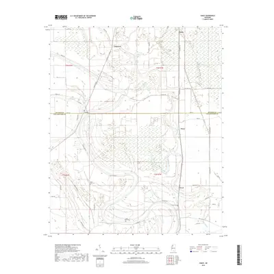
2018 Map of Vance
USGS Topo · Published 2018About this map
The boundary between Quitman Co and Tallahatchie Co divides this landscape, where the flat alluvial plains of the Mississippi Delta are defined by complex drainage networks and small rural hamlets. The settlement of Vance sits directly on this county line, serving as a focal point for the surrounding agricultural community. To the south, the village of Brazil is positioned near the winding course of Buzzard Bayou, a prominent water feature that snakes through the southern portion of the quadrangle.
Find a feature on this map
51 named features on this map. Tap any name to fly to it.
Don’t see what you’re looking for? This feature index may not catch every label — zoom into the map to look around manually.
Map Details
Editions of this 2018 Vance Map
This is the sole edition of this map. No revisions or reprints were ever made.
Other maps of this area

1931 · Sumner
USGS Topo · 1:48,000

1932 · Philipp
USGS Topo · 1:48,000

1932 · Tutwiler
USGS Topo · 1:48,000

1935 · Crowder
USGS Topo · 1:62,500

1935 · Sumner
USGS Topo · 1:62,500

1935 · Tutwiler
USGS Topo · 1:62,500

1935 · Philipp
USGS Topo · 1:62,500

1939 · Sumner
USGS Topo · 1:62,500

1939 · Crowder
USGS Topo · 1:62,500

1939 · Philipp
USGS Topo · 1:62,500