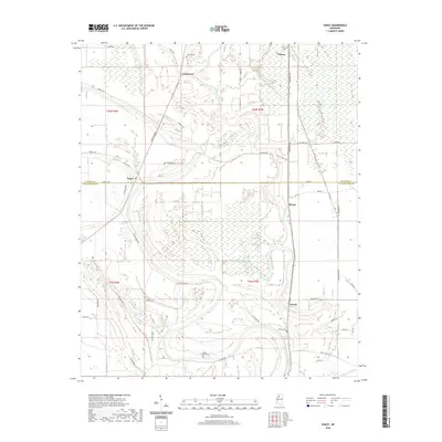
2020 Map of Vance
USGS Topo · Published 2020About this map
Vance sits at the junction of Quitman and Tallahatchie counties, serving as a focal point for this section of the Mississippi Delta. The landscape is defined by the winding course of Buzzard Bayou and the swampy lowlands of Beaver Ruin Brake, illustrating the complex hydrology of the region. Small rural settlements like Brazil, Hiram, and Longstreet are scattered throughout the agricultural grid, connected by a network of local roads such as Charlie Pride and Government Rd. For genealogists and local historians, the map provides precise locations for family-named cemeteries, including Silent Shade Cem, Shady Grove Cem, and Johnson Cem. The presence of numerous brakes and bayous alongside these small communities reflects a traditional Delta settlement pattern where high ground was at a premium for both homesites and burial grounds.
Find a feature on this map
49 named features on this map. Tap any name to fly to it.
Don’t see what you’re looking for? This feature index may not catch every label — zoom into the map to look around manually.
Map Details
Editions of this 2020 Vance Map
This is the sole edition of this map. No revisions or reprints were ever made.
Other maps of this area

1931 · Sumner
USGS Topo · 1:48,000

1932 · Philipp
USGS Topo · 1:48,000

1932 · Tutwiler
USGS Topo · 1:48,000

1935 · Crowder
USGS Topo · 1:62,500

1935 · Sumner
USGS Topo · 1:62,500

1935 · Tutwiler
USGS Topo · 1:62,500

1935 · Philipp
USGS Topo · 1:62,500

1939 · Sumner
USGS Topo · 1:62,500

1939 · Crowder
USGS Topo · 1:62,500

1939 · Philipp
USGS Topo · 1:62,500