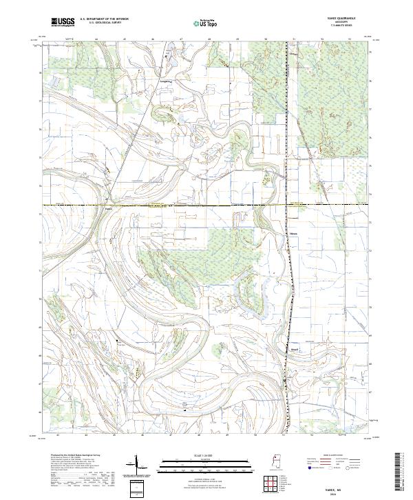
2024 Map of Vance
USGS Topo · Published 2024About this map
Buzzard Bayou meanders through the heart of this Delta landscape, defining the hydrological character of the border between Quitman and Tallahatchie counties. The settlement of Vance sits at a crossroads of the regional drainage and road network, where Wilbourne Dr and Quitman Rd intersect. The terrain is marked by significant wetlands and water bodies, most notably the Beaver Ruin Brake, which illustrate the complex bottomland geography of Northwest Mississippi. Local history is preserved in several rural burial grounds scattered across the quadrangle, including Shady Grove Cem near the center and Silent Shade Cem to the south. Other small community centers like Brazil, Hiram, and Longstreet serve as anchors for the agricultural tracts, while a portion of the Farm Service Agency Interest of Mississippi occupies the eastern portion of the survey.
Find a feature on this map
51 named features on this map. Tap any name to fly to it.
Don’t see what you’re looking for? This feature index may not catch every label — zoom into the map to look around manually.
Map Details
Editions of this 2024 Vance Map
This is the sole edition of this map. No revisions or reprints were ever made.
Other maps of this area

1931 · Sumner
USGS Topo · 1:48,000

1932 · Philipp
USGS Topo · 1:48,000

1932 · Tutwiler
USGS Topo · 1:48,000

1935 · Crowder
USGS Topo · 1:62,500

1935 · Sumner
USGS Topo · 1:62,500

1935 · Tutwiler
USGS Topo · 1:62,500

1935 · Philipp
USGS Topo · 1:62,500

1939 · Sumner
USGS Topo · 1:62,500

1939 · Crowder
USGS Topo · 1:62,500

1939 · Philipp
USGS Topo · 1:62,500