
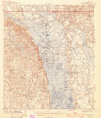
1944 Map of Vancleave
USGS Topo · Published 1944About this map
The Pascagoula River corridor dominates this 1940s landscape, winding through a complex system of sloughs and dead rivers like Dogged Dead River and Stead Dead River. The settlement of Vancleave serves as a primary hub on the western bluffs, while the eastern side is defined by smaller communities like Wade and Harleston. This era captures a river-dependent geography where Graham Ferry remains a vital landmark and numerous landings like McCall Landing and Portico Landing dot the banks.
Find a feature on this map
120 named features on this map. Tap any name to fly to it.
Don’t see what you’re looking for? This feature index may not catch every label — zoom into the map to look around manually.
Map Details
Editions of this 1944 Vancleave Map
2 editions found
Other maps of this area

1921 · Grand Bay
USGS Topo · 1:62,500

1941 · Hurley
USGS Topo · 1:62,500

1941 · Vancleave
USGS Topo · 1:62,500

1941 · Lucedale
USGS Topo · 1:62,500

1942 · Wilmer
USGS Topo · 1:62,500

1943 · Pascagoula
USGS Topo · 1:62,500

1943 · Lucedale
USGS Topo · 1:62,500

1943 · Grand Bay
USGS Topo · 1:62,500

1943 · Hurley
USGS Topo · 1:62,500

1943 · Vancleave
USGS Topo · 1:62,500