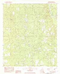
1982 Map of Vancleave
USGS Topo · Published 1982About this map
Vancleave serves as the central hub of this Mississippi landscape, situated just west of the sprawling wetlands and winding channels of the Pascagoula River. The map reveals a community defined by its proximity to water and its spiritual centers, featuring numerous local landmarks like Beulah Ch, First Baptist Ch, and Mt Pleasant Ch. Along the eastern edge, the river environment is characterized by a complex network of sloughs and lakes, including Polly Lake, Black Lake, and Sandy Slough, which were essential for local navigation and recreation at McCall Landing and Dees Landing Boat Ramp. To the south, the settlement of Evergreen and the Home of Grace sit near the junction of several bayous, reflecting the rural development of Jackson County in the early 1980s. For those researching local families, the presence of Ladner Cem and Carter Cem provides specific points for genealogical study.
Find a feature on this map
62 named features on this map. Tap any name to fly to it.
Don’t see what you’re looking for? This feature index may not catch every label — zoom into the map to look around manually.
Map Details
Editions of this 1982 Vancleave Map
2 editions found
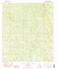
Other maps of this area

1941 · Vancleave
USGS Topo · 1:62,500

1943 · Pascagoula
USGS Topo · 1:62,500

1943 · Vancleave
USGS Topo · 1:62,500

1944 · Vancleave
USGS Topo · 1:62,500

1953 · Mobile
USGS Topo · 1:250,000

1954 · Vestry
USGS Topo · 1:62,500

1954 · Ocean Springs
USGS Topo · 1:24,000

1954 · Biloxi
USGS Topo · 1:62,500

1955 · Pascagoula
USGS Topo · 1:62,500

1957 · Mobile
USGS Topo · 1:250,000