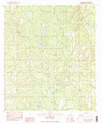
1982 Map of Vancleave
USGS Topo · Published 1982About this map
Vancleave sits at the heart of this landscape, surrounded by a dense network of bayous and creeks that drain into the Pascagoula River. This 1980s-era survey documents a community defined by its proximity to the river bottomlands, with several landings such as McCall Landing and Dees Landing suggesting the area's continued connection to the water. The map traces the winding course of Poticaw Bayou and Moungers Creek, which cut through a terrain of low bluffs and marshy flats. Local institutional life is well-documented through numerous country churches, including Beulah Ch and Magnolia Ch, alongside the High Sch in the town center. The eastern edge is dominated by the Pascagoula River State Wildlife Management Area, preserving a wilder stretch of river lakes like Polly Lake and Cat Lake that stand in contrast to the developed corridors along Seaman Road and Wade Vancleave Road.
Find a feature on this map
57 named features on this map. Tap any name to fly to it.
Don’t see what you’re looking for? This feature index may not catch every label — zoom into the map to look around manually.
Map Details
Editions of this 1982 Vancleave Map
2 editions found
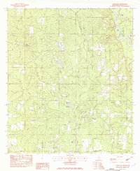
Other maps of this area

1941 · Vancleave
USGS Topo · 1:62,500

1943 · Pascagoula
USGS Topo · 1:62,500

1943 · Vancleave
USGS Topo · 1:62,500

1944 · Vancleave
USGS Topo · 1:62,500

1953 · Mobile
USGS Topo · 1:250,000

1954 · Vestry
USGS Topo · 1:62,500

1954 · Ocean Springs
USGS Topo · 1:24,000

1954 · Biloxi
USGS Topo · 1:62,500

1955 · Pascagoula
USGS Topo · 1:62,500

1957 · Mobile
USGS Topo · 1:250,000