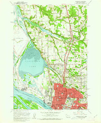
1961 Map of Vancouver
USGS Topo · Published 1962About this map
The industrial and educational hub of Vancouver sits at the northern edge of the Columbia River, where heavy industry like the Aluminum Plant meets the city's historic core. This early 1960s survey captures a landscape of institutional importance, featuring both the Washington Sch for the Deaf and the Washington Sch for the Blind alongside Clark College and the Fort Vancouver Nat Mon. The riverfront is a complex network of rail and water transport, dominated by the Spokane Portland and Seattle Railroad and the Port of Vancouver.
Find a feature on this map
78 named features on this map. Tap any name to fly to it.
Don’t see what you’re looking for? This feature index may not catch every label — zoom into the map to look around manually.
Map Details
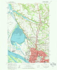
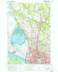
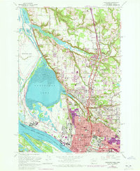
Editions of this 1961 Vancouver Map
5 editions found

Other maps of this area

1897 · Portland
USGS Topo · 1:62,500

1905 · Portland
USGS Topo · 1:62,500

1915 · Hillsboro
USGS Topo · 1:62,500

1918 · Hillsboro
USGS Topo · 1:62,500

1922 · St. Helens
USGS Topo · 1:62,500

1940 · Hillsboro
USGS Topo · 1:62,500

1940 · Portland
USGS Topo · 1:62,500

1940 · La Center
USGS Topo · 1:62,500

1941 · St Helens
USGS Topo · 1:62,500

1943 · St Helens
USGS Topo · 1:62,500