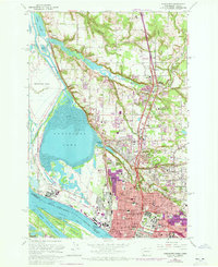
1961 Map of Vancouver
USGS Topo · Published 1972About this map
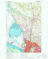
Vancouver Lake and the Columbia River dominate the landscape of this 1961 survey, which also includes 1970 photo-revisions shown in purple. These revisions highlight the rapid expansion of Vancouver northward toward Salmon Creek and Minnehaha. The industrial character of the waterfront is evident near Mathews Point, where the Aluminum Plant and Burlington Northern rail lines interface with the shipping channels of Friendly Reach.
Find a feature on this map
80 named features on this map. Tap any name to fly to it.
Don’t see what you’re looking for? This feature index may not catch every label — zoom into the map to look around manually.
Map Details
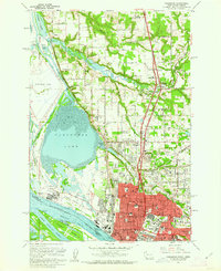
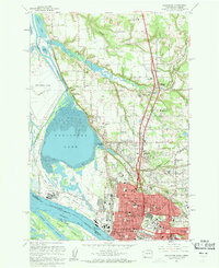
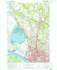
Editions of this 1961 Vancouver Map
5 editions found
Other maps of this area

1897 · Portland
USGS Topo · 1:62,500

1905 · Portland
USGS Topo · 1:62,500

1915 · Hillsboro
USGS Topo · 1:62,500

1918 · Hillsboro
USGS Topo · 1:62,500

1922 · St. Helens
USGS Topo · 1:62,500

1940 · Hillsboro
USGS Topo · 1:62,500

1940 · Portland
USGS Topo · 1:62,500

1940 · La Center
USGS Topo · 1:62,500

1941 · St Helens
USGS Topo · 1:62,500

1943 · St Helens
USGS Topo · 1:62,500