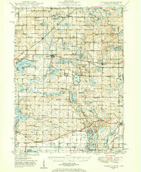
1948 Map of Vandalia
USGS Topo · Published 1959About this map
Vandalia and the surrounding townships of Cass County are defined by a complex network of glacial lakes and small rural settlements during the late 1940s. The Grand Trunk railroad corridor links the village of Penn with Vandalia and Jones, serving a landscape dotted with numerous country schools like Allegheny Sch and Red Brick Sch. The map reveals a high density of civic and religious institutions, including the Town Hall in Porter and several notable places of worship such as Chain Lake Ch and Mt Zion Ch.
Find a feature on this map
194 named features on this map. Tap any name to fly to it.
Don’t see what you’re looking for? This feature index may not catch every label — zoom into the map to look around manually.
Map Details
Editions of this 1948 Vandalia Map
5 editions found

Other maps of this area

1914 · Three Rivers
USGS Topo · 1:62,500

1916 · Three Rivers
USGS Topo · 1:62,500

1922 · Schoolcraft
USGS Topo · 1:62,500

1927 · Hartford
USGS Topo · 1:62,500

1931 · Hartford
USGS Topo · 1:62,500

1943 · Three Rivers
USGS Topo · 1:62,500

1943 · Schoolcraft
USGS Topo · 1:62,500

1944 · Marcellus
USGS Topo · 1:62,500

1945 · Cassopolis
USGS Topo · 1:62,500

1946 · Marcellus
USGS Topo · 1:62,500