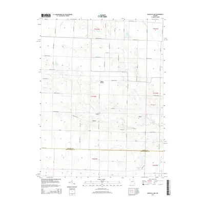
2014 Map of Vandalia Lake
USGS Topo · Published 2014About this map
Culiver sits at the heart of this agricultural landscape in the mid-2010s, where the rural character of northern Missouri is defined by its winding creek systems and scattered family burial grounds. The drainage of the W Fork Cuivre River and Hickory Cr shapes the terrain, leading toward larger bodies of water like Vandalia Lake. This era shows a well-established grid of county roads, such as Audrain Road 516 and Audrain Road 637, which connect local landmarks and farming communities. Genealogists will find significant value in the documentation of several local cemeteries, including New Providence Cemetery, Edwards Cemetery, and Fike Cemetery, which serve as quiet anchors for the surrounding countryside. Smaller water features like Bear Slough, Lost Cr, and Elmer Force Lake further detail the local topography, reflecting the intricate natural drainage before it crosses the southern boundary near the Audrain Co Montgomery Co line.
Find a feature on this map
71 named features on this map. Tap any name to fly to it.
Don’t see what you’re looking for? This feature index may not catch every label — zoom into the map to look around manually.
Map Details
Editions of this 2014 Vandalia Lake Map
This is the sole edition of this map. No revisions or reprints were ever made.
Other maps of this area

1890 · Louisiana
USGS Topo · 1:125,000

1890 · Mexico
USGS Topo · 1:125,000

1942 · Wellsville
USGS Topo · 1:62,500

1942 · Bellflower
USGS Topo · 1:62,500

1943 · Vandalia
USGS Topo · 1:62,500

1945 · Bellflower
USGS Topo · 1:62,500

1945 · Perry
USGS Topo · 1:62,500

1945 · Vandalia
USGS Topo · 1:62,500

1948 · Quincy
USGS Topo · 1:250,000

1956 · Quincy
USGS Topo · 1:250,000