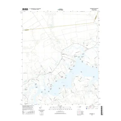
2016 Map of Vandemere
USGS Topo · Published 2016About this map
Vandemere sits at the junction of Vandemere Creek and the Bay River, anchoring a coastal landscape defined by intricate waterways and low-lying points. This 2016 survey shows the community layout near Hollyville and Mesic, where the land fragments into numerous named geographic features such as Graveyard Point, Alligator Point, and White Pine Shoal. The map details the transition from the dense Gum Swamp in the north to the more open waters of Parch Corn Bay and Moore Bay to the south.
Find a feature on this map
103 named features on this map. Tap any name to fly to it.
Don’t see what you’re looking for? This feature index may not catch every label — zoom into the map to look around manually.
Map Details
Editions of this 2016 Vandemere Map
This is the sole edition of this map. No revisions or reprints were ever made.
Other maps of this area

1948 · Oriental
USGS Topo · 1:24,000

1950 · Vandemere
USGS Topo · 1:24,000

1950 · Lowland
USGS Topo · 1:24,000

1950 · South Creek
USGS Topo · 1:24,000

1950 · Jones Bay
USGS Topo · 1:24,000

1950 · Aurora
USGS Topo · 1:24,000

1950 · Arapahoe
USGS Topo · 1:24,000

1951 · Arapahoe
USGS Topo · 1:24,000

1951 · Broad Creek
USGS Topo · 1:24,000

1953 · Rocky Mount
USGS Topo · 1:250,000