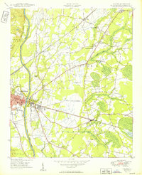
1949 Map of Vander
USGS Topo · Published 1949About this map
The Cape Fear River carves through the western edge of this landscape just east of Fayetteville, where the transition from town to rural Cumberland County is marked by a dense network of early schools and churches. This post-war era survey shows the convergence of several major rail lines, including the Atlantic Coast Line and the Aberdeen and Rockfish, which served the local timber and agricultural economy.
Find a feature on this map
30 named features on this map. Tap any name to fly to it.
Don’t see what you’re looking for? This feature index may not catch every label — zoom into the map to look around manually.
Map Details
Editions of this 1949 Vander Map
2 editions found
Other maps of this area

1948 · Fayetteville
USGS Topo · 1:62,500

1948 · Slocomb
USGS Topo · 1:24,000

1949 · Vander
USGS Topo · 1:24,000

1950 · Fayetteville
USGS Topo · 1:24,000

1950 · Manchester
USGS Topo · 1:24,000

1950 · Slocomb
USGS Topo · 1:24,000

1953 · Florence
USGS Topo · 1:250,000

1953 · Raleigh
USGS Topo · 1:250,000

1954 · Florence
USGS Topo · 1:250,000

1954 · Raleigh
USGS Topo · 1:250,000