
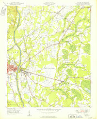
1949 Map of Vander
USGS Topo · Published 1949About this map
The Cape Fear River and the convergence of major rail lines define this mid-century landscape east of Fayetteville. In the years following the war, this portion of Cumberland County remained largely agricultural, with small rural hubs like Vander and Beard anchored by schools and churches. The Atlantic Coast Line and Norfolk Southern railroads cut through the terrain, illustrating the transit corridor's importance to the regional economy.
Find a feature on this map
39 named features on this map. Tap any name to fly to it.
Don’t see what you’re looking for? This feature index may not catch every label — zoom into the map to look around manually.
Map Details
Editions of this 1949 Vander Map
2 editions found
Other maps of this area

1948 · Fayetteville
USGS Topo · 1:62,500

1948 · Slocomb
USGS Topo · 1:24,000

1950 · Fayetteville
USGS Topo · 1:24,000

1950 · Manchester
USGS Topo · 1:24,000

1950 · Slocomb
USGS Topo · 1:24,000

1953 · Florence
USGS Topo · 1:250,000

1953 · Raleigh
USGS Topo · 1:250,000

1954 · Florence
USGS Topo · 1:250,000

1954 · Raleigh
USGS Topo · 1:250,000

1957 · Vander
USGS Topo · 1:24,000