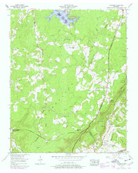
1956 Map of Vandever
USGS Topo · Published 1977About this map
The Tennessee Valley Divide snakes through this high country of the Cumberland Plateau, separating waters that flow toward the Tennessee River from those of the Sequatchie River. The landscape is a mix of small upland settlements like Vandever and New Era and the industrial-scale agricultural footprint of Grassland Farm. To the north, the waters of Harrison Lake and the Tansi Resort indicate the mid-century development of the area's recreational geography. Along the eastern escarpment, the map reveals the steep descent into the Sequatchie Valley via Morris Gap and Stephens Gap. The density of family-named cemeteries such as Hillcrest Cem and Musick Cem, alongside rural landmarks like Carding Machine Spring, provides a detailed record of the families who settled this high ground before modern highways fully integrated the plateau.
Find a feature on this map
63 named features on this map. Tap any name to fly to it.
Don’t see what you’re looking for? This feature index may not catch every label — zoom into the map to look around manually.
Map Details
Editions of this 1956 Vandever Map
3 editions found
Other maps of this area

1887 · Kingston
USGS Topo · 1:125,000

1891 · Kingston
USGS Topo · 1:125,000

1892 · Pikeville
USGS Topo · 1:125,000

1893 · Kingston
USGS Topo · 1:125,000

1895 · Pikeville
USGS Topo · 1:125,000

1909 · Sequatchie Valley
USGS Topo · 1:62,500

1910 · Pikeville
USGS Topo · 1:62,500

1912 · Crossville
USGS Topo · 1:62,500

1935 · Melvine
USGS Topo · 1:24,000

1935 · Pennine
USGS Topo · 1:24,000