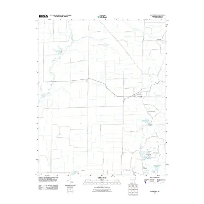
2011 Map of Vanndale
USGS Topo · Published 2011About this map
Vanndale serves as a central point of this Cross County landscape, where the agricultural flats of eastern Arkansas meet an extensive network of water management systems. The western edge is defined by the winding course of the L'Anguille River, while the eastern terrain is marked by a series of reservoirs and flood control structures, including the Caney Creek Site One Reservoir, Gardner Lake, and Pufahl Reservoir. This era of mapping shows a countryside crisscrossed by a rigid grid of county roads, such as Whitby Rd and Tommy Hare Rd, which connect small communities and family landmarks. Genealogists will find interest in the documented locations of Warren Cemetery and Mount Maria Cemetery, while the presence of Fair Field and Mersman provides evidence of the enduring rural settlement patterns in this part of the Mississippi Alluvial Plain.
Find a feature on this map
60 named features on this map. Tap any name to fly to it.
Don’t see what you’re looking for? This feature index may not catch every label — zoom into the map to look around manually.
Map Details
Editions of this 2011 Vanndale Map
This is the sole edition of this map. No revisions or reprints were ever made.
Other maps of this area

1939 · Vanndale
USGS Topo · 1:62,500

1939 · Wynne
USGS Topo · 1:62,500

1940 · Princedale
USGS Topo · 1:62,500

1940 · Whitmore
USGS Topo · 1:62,500

1953 · Memphis
USGS Topo · 1:250,000

1956 · Memphis
USGS Topo · 1:250,000

1956 · Whitmore
USGS Topo · 1:62,500

1956 · Princedale
USGS Topo · 1:62,500

1958 · Wynne
USGS Topo · 1:62,500

1958 · Vanndale
USGS Topo · 1:62,500