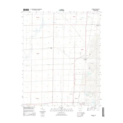
2014 Map of Vanndale
USGS Topo · Published 2014About this map
Vanndale and the northern outskirts of Wynne anchor this portrait of Cross County, where the Crowley's Ridge terrain meets the alluvial delta. The landscape is defined by its water management and agricultural grid, featuring the meandering L'Anguille River and numerous catchments including Pufahl Reservoir and the Caney Cr Site One Reservoir system. These water bodies, along with Gardner Lake and Hall Lake, illustrate the complex drainage and irrigation infrastructure essential to this region of Arkansas.
Find a feature on this map
65 named features on this map. Tap any name to fly to it.
Don’t see what you’re looking for? This feature index may not catch every label — zoom into the map to look around manually.
Map Details
Editions of this 2014 Vanndale Map
This is the sole edition of this map. No revisions or reprints were ever made.
Other maps of this area

1939 · Vanndale
USGS Topo · 1:62,500

1939 · Wynne
USGS Topo · 1:62,500

1940 · Princedale
USGS Topo · 1:62,500

1940 · Whitmore
USGS Topo · 1:62,500

1953 · Memphis
USGS Topo · 1:250,000

1956 · Memphis
USGS Topo · 1:250,000

1956 · Whitmore
USGS Topo · 1:62,500

1956 · Princedale
USGS Topo · 1:62,500

1958 · Wynne
USGS Topo · 1:62,500

1958 · Vanndale
USGS Topo · 1:62,500