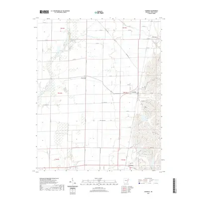
2020 Map of Vanndale
USGS Topo · Published 2020About this map
Wynne anchors the southern boundary of this Cross County landscape, where the flat alluvial plains of the L'Anguille River meet the rising topography of the east. This transition is marked by a network of drainage ways including Prairie Cr and McFaran Br, supporting the agricultural character of the region. The map documents smaller settlements and local landmarks like Vanndale, Fair Field, and Mersman, which are connected by a grid of rural roads and curiously named thoroughfares such as Million Dollar Rd. For those researching local families, the presence of Warren Cem and Mount Maria Cem provides specific points of interest for genealogical study. The layout of the roads, including Halk Cemetery Rd and Freck Anderson Rd, reflects a history of family-land ownership and the systematic division of the Arkansas Delta.
Find a feature on this map
55 named features on this map. Tap any name to fly to it.
Don’t see what you’re looking for? This feature index may not catch every label — zoom into the map to look around manually.
Map Details
Editions of this 2020 Vanndale Map
This is the sole edition of this map. No revisions or reprints were ever made.
Other maps of this area

1939 · Vanndale
USGS Topo · 1:62,500

1939 · Wynne
USGS Topo · 1:62,500

1940 · Princedale
USGS Topo · 1:62,500

1940 · Whitmore
USGS Topo · 1:62,500

1953 · Memphis
USGS Topo · 1:250,000

1956 · Memphis
USGS Topo · 1:250,000

1956 · Whitmore
USGS Topo · 1:62,500

1956 · Princedale
USGS Topo · 1:62,500

1958 · Wynne
USGS Topo · 1:62,500

1958 · Vanndale
USGS Topo · 1:62,500