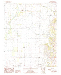
1984 Map of Vanndale
USGS Topo · Published 1985About this map
Crowleys Ridge rises distinctly above the alluvial plains of eastern Arkansas, forming a geologic spine that anchors the community of Vanndale. This 1984 survey reveals the stark transition from the higher, wooded elevations of the ridge down to the intensive agricultural bottomlands of the L'Anguille River valley. Water management defines the lower landscape, where natural watercourses like Mc Faran Branch and Prairie Creek are supplemented by the engineered Gregory Ditch to facilitate drainage for the surrounding fields.
Find a feature on this map
17 named features on this map. Tap any name to fly to it.
Don’t see what you’re looking for? This feature index may not catch every label — zoom into the map to look around manually.
Map Details
Editions of this 1984 Vanndale Map
This is the sole edition of this map. No revisions or reprints were ever made.
Other maps of this area

1939 · Vanndale
USGS Topo · 1:62,500

1939 · Wynne
USGS Topo · 1:62,500

1940 · Princedale
USGS Topo · 1:62,500

1940 · Whitmore
USGS Topo · 1:62,500

1953 · Memphis
USGS Topo · 1:250,000

1956 · Memphis
USGS Topo · 1:250,000

1956 · Whitmore
USGS Topo · 1:62,500

1956 · Princedale
USGS Topo · 1:62,500

1958 · Wynne
USGS Topo · 1:62,500

1958 · Vanndale
USGS Topo · 1:62,500