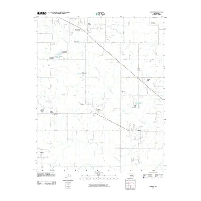
2010 Map of Vanoss
USGS Topo · Published 2010About this map
Oil Center and the surrounding Pontotoc County countryside reveal a landscape shaped by petroleum extraction and modern water management. This 2010 survey details the extensive energy infrastructure of the Beebee-Southwest Konawa Oil and Gas Field and the Northeast Bebee Oil and Gas Field, where the grid of county roads connects scattered operations with rural settlements. A series of flood control structures and reservoirs, including Oknoname 123004 Reservoir and multiple Sandy Creek Site 22 Dam installations, manage the drainage of Spring Brook Creek and its tributaries.
Find a feature on this map
64 named features on this map. Tap any name to fly to it.
Don’t see what you’re looking for? This feature index may not catch every label — zoom into the map to look around manually.
Map Details
Editions of this 2010 Vanoss Map
This is the sole edition of this map. No revisions or reprints were ever made.
Other maps of this area

1901 · Stonewall
USGS Topo · 1:125,000

1957 · Ardmore
USGS Topo · 1:250,000

1958 · Ada
USGS Topo · 1:24,000

1958 · Vamoosa
USGS Topo · 1:24,000

1958 · Konawa
USGS Topo · 1:24,000

1963 · Ardmore
USGS Topo · 1:250,000

1966 · Asher
USGS Topo · 1:24,000

1967 · Ahloso
USGS Topo · 1:24,000
1967 · Vanoss
USGS Topo · 1:24,000
1967 · Stratford
USGS Topo · 1:24,000