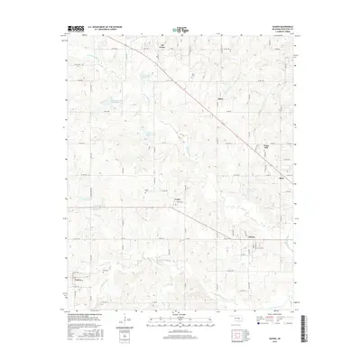
2016 Map of Vanoss
USGS Topo · Published 2016About this map
Vanoss and Oil Center anchor this rural landscape in Pontotoc County, where agricultural and petroleum-related heritage intersect across the rolling Oklahoma terrain. The map documents an extensive network of water management through the numerous Soil Conservation Service reservoirs, including Sandy Cr Site 30 Reservoir and Sandy Creek Site 21 Reservoir, which protect the drainage basins of Canadian Sandy Cr and Spring Brook Cr. Local genealogists will find significant value in the documentation of family-named landmarks and historic burial grounds, such as Mass Cem, Center Cem, and the uniquely named Box X Cem. Small unincorporated communities like Pickett, Bebee, and Union Hill remain connected by a dense grid of county roads, including Co RD 1540 and Co RD 1490, while the northwestern corner of Ada begins to emerge along the eastern edge of the quadrangle.
Find a feature on this map
51 named features on this map. Tap any name to fly to it.
Don’t see what you’re looking for? This feature index may not catch every label — zoom into the map to look around manually.
Map Details
Editions of this 2016 Vanoss Map
This is the sole edition of this map. No revisions or reprints were ever made.
Other maps of this area

1901 · Stonewall
USGS Topo · 1:125,000

1957 · Ardmore
USGS Topo · 1:250,000

1958 · Ada
USGS Topo · 1:24,000

1958 · Vamoosa
USGS Topo · 1:24,000

1958 · Konawa
USGS Topo · 1:24,000

1963 · Ardmore
USGS Topo · 1:250,000

1966 · Asher
USGS Topo · 1:24,000

1967 · Ahloso
USGS Topo · 1:24,000
1967 · Vanoss
USGS Topo · 1:24,000
1967 · Stratford
USGS Topo · 1:24,000