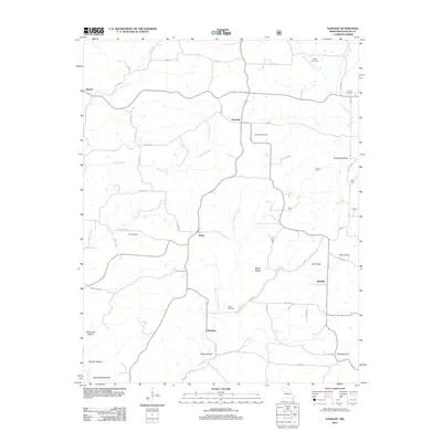
2012 Map of Vanzant
USGS Topo · Published 2012About this map
Buckhart and Vanzant anchor a network of small crossroads communities across Douglas County, Missouri, during this 2012 survey. The landscape is defined by the headwaters of Brush Creek and its West Fork, which carve through the high ground of White Ridge and Nye Ridge. These ridges served as natural corridors for early development, now followed by local routes like CO RD-256 and CO RD-263.
Find a feature on this map
47 named features on this map. Tap any name to fly to it.
Don’t see what you’re looking for? This feature index may not catch every label — zoom into the map to look around manually.
Map Details
Editions of this 2012 Vanzant Map
This is the sole edition of this map. No revisions or reprints were ever made.
Other maps of this area

1937 · Buckhart
USGS Topo · 1:48,000

1939 · Topaz
USGS Topo · 1:62,500

1941 · Topaz
USGS Topo · 1:62,500

1943 · Buckhart
USGS Topo · 1:62,500

1945 · Harrison
USGS Topo · 1:250,000

1945 · Buckhart
USGS Topo · 1:62,500

1949 · Harrison
USGS Topo · 1:250,000

1950 · Cabool SW
USGS Topo · 1:24,000

1951 · Norwood
USGS Topo · 1:24,000

1951 · Mountain Grove South
USGS Topo · 1:24,000