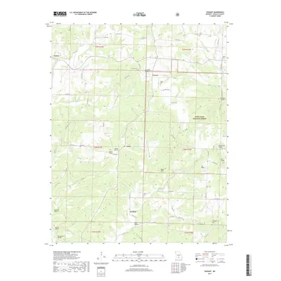
2017 Map of Vanzant
USGS Topo · Published 2017About this map
Vanzant and Buckhart are central points of settlement in this Ozark landscape, characterized by a complex network of ridges and deep-set hollows. The terrain is marked by distinctive local landmarks like Twin Knobs and Campbell Hill, while the drainage system of Greasy Cr and Clifty Cr dictates the path of winding county roads. Small crossroads communities such as Drury and Denlow highlight the dispersed settlement pattern typical of Douglas County, where agriculture and forestry meet. Genealogy researchers will find significant value in the distribution of family-named burial sites, including Vanzant Cem, Tedrick Cem, and Penner Cem, which are scattered throughout the hills. A portion of the Mark Twain National Forest occupies the eastern section of the map, illustrating the balance between public conservation lands and private homesteads near White Ridge and Nye Ridge.
Find a feature on this map
75 named features on this map. Tap any name to fly to it.
Don’t see what you’re looking for? This feature index may not catch every label — zoom into the map to look around manually.
Map Details
Editions of this 2017 Vanzant Map
This is the sole edition of this map. No revisions or reprints were ever made.
Other maps of this area

1937 · Buckhart
USGS Topo · 1:48,000

1939 · Topaz
USGS Topo · 1:62,500

1941 · Topaz
USGS Topo · 1:62,500

1943 · Buckhart
USGS Topo · 1:62,500

1945 · Harrison
USGS Topo · 1:250,000

1945 · Buckhart
USGS Topo · 1:62,500

1949 · Harrison
USGS Topo · 1:250,000

1950 · Cabool SW
USGS Topo · 1:24,000

1951 · Norwood
USGS Topo · 1:24,000

1951 · Mountain Grove South
USGS Topo · 1:24,000